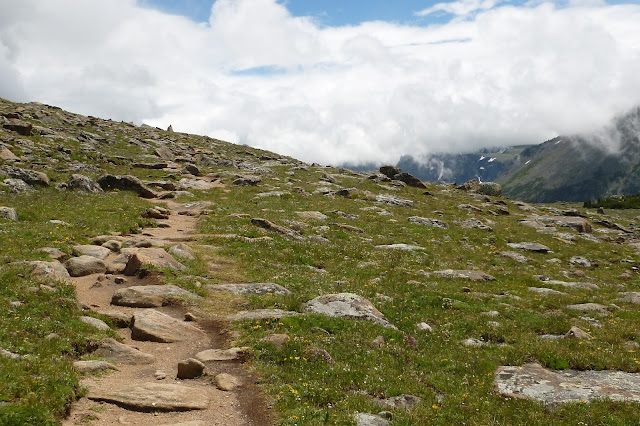
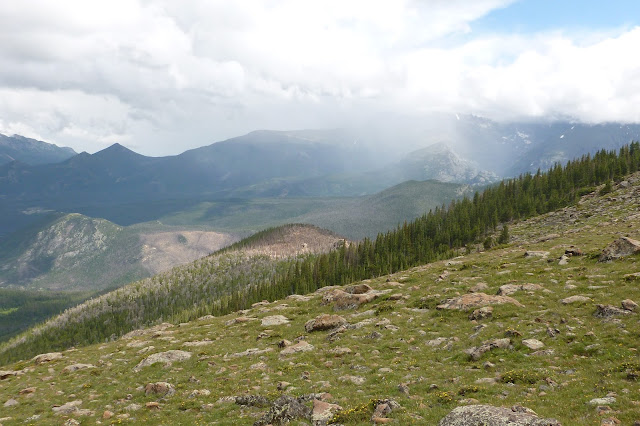
We spent a lot of time sight seeing along Trail Ridge Road going up to the Alpine Visitor Center so a separate blog post is needed for this part of trip to the Rockies. Spectacular vistas can be viewed from each of the many overlooks and from many of the trails. Most of what was once the Ute Trail is now Trail Ridge Road - the highest continuous road in the United States.
My favorite hikes are the Ute trails. There are two Ute trails one that starts across from the Alpine Visitor Center and goes down to Milner Pass/Continental Divide. The other part of this trail is found just 2 miles east of the Alpine Visitor Center leading to Beaver Meadows. We couldn't do the whole trail so we opted to hike halfway down each of these trails.
It is nice and cool up in the alpine area. I would say about 43F on the days we went, perfect for hiking. Elevation about 11,700 feet. The weather changes so quickly here, sunny to cloudy, wind, rain and hail, thunder and lightening can come out of nowhere. A storm can last 30 minutes, go away and then come back again an hour later. So when hiking you have to be prepared with a rain coat and hope you don't get caught on a trail when there is lightening, you are totally exposed and your body acts a as lightening rod. The Rangers advise that hiking be done in the morning hours when storms are less likely to occur.
Oh, by the way, cell phones don't work up here.
Ute trail photos from the Alpine Visitor Center. This trail leads to the Milner Pass, also known as The Continental divide, about 4.3 miles one way. I just hiked about halfway then turned back. The trail is smooth and not rocky, easy to hike, the elevation gradually decreases as you head towards Milner Pass.

A Yellow-Bellied Marmot (a type of ground squirrel). These critters hibernate underground for 8 months and will go as deep as 15 feet.
Three female elk just hanging out. I wonder where they go during a storm, and when there's lightening.
After about two miles, you will see Forest Pass Canyon, with more and more trees along the trail. Eventually the trees will be much taller as you enter the sub-alpine zone. I went beyond these point for awhile then turned back.
Now, for the next part of the Ute Trail. The trail head can be found 2 miles east of the Alpine Visitor Center on Trail Ridge Road. There is only room for about four or five cars for parking, not a lot of people walk this trail.
It is very rocky, difficult to walk, better have good hiking shoes on. This trail leads to Beaver Meadows about a 6.5 mile hike one way. I hiked to a point called Timberline Pass (about 2.2 miles) then turned back.
If you decide on hiking these trails, I would suggest purchasing a National Geographic Map at the Alpine Visitor Center, about $12. The map that they give you at the ranger visitor center is sufficient but not really detailed. Also a raincoat is better to wear when it is rainy and windy. Ponchos flop around in the wind too much and the noise it makes is annoying.
Next two photos, hubby and myself.
The next two photos show an area called Tombstone Ridge. Up close they look a little scary. Big giant boulders ready to fall and roll over you. So I took photos after I passed them up, didn't want to stand there too long.
The following five photos show an area called Timberline Pass marked by a two humped rock outcrop. This is where you start to see the top of the treeline. I decided to turn around here and head back.
The alpine may not have any trees, but the ground is covered with many pretty little flowers.
Ponchos don't work well, it's all wrapped around my husband's head.
Beautiful ending to a hike with a rainbow in the background, also showing Trail Ridge Road where we parked


Thank you so much for sharing you wonderful trip. I love all of your photos, just gorgeous!
ReplyDeleteAwesome photos, Diane! Thanks for sharing this. Sure wish there were mountains around here. :)
ReplyDeleteFabulous photos! Thank you so much for sharing your trip with us. I want to go now.
ReplyDeleteAbsolutely stunning scenery - photos are gorgeous! Thank you for sharing this great adventure. Something else to add to my bucket list.
ReplyDeleteLisa :)
These photos are awesome. It is just like being there. Thanks for sharing this gorgeous scenery with us!
ReplyDeleteGreat accounting of your hiking up in the Rocky Mountains!! Never made it to that section of Colorado - I ended up spending all my vacations in Colorado in the Mountains north of Durango in southwest Colorado, where I did hiking and taking photos - but have driven through the Rockies - looks like it was a great time!!
ReplyDeleteWOW, the photos are just stunning. Thank you for sharing.
ReplyDeleteThat is an absolutely stunning hike! I really appreciate your sharing a bit of the trail!
ReplyDeleteSo jealous! Your hike looks like so much fun, even if the weather was a bit temperamental. You know you have some elevation when you start seeing marmots :) Great post, and thank you so much for sharing. Now, I have a trail to add to my lists.
ReplyDeleteOh, my . . . I could just smell and feel the cold mountain air. Nothing like it! Your photos are stunning, Diane. Now I've got the wanderlust to go back up that way. It's been waaaay too long. Thank you fro sharing your trip. The wait for the second installment was well worth it (:
ReplyDeleteWow, such beauty! Looks chilly. I enjoyed hiking along with you via my comfy chair! lol
ReplyDelete